The Queen Charlotte Track is a multi-day hike that, much like its counterpart, the Abel Tasman Track, can be turned into a day hike. It’s perfect for those of us who love to hike but enjoy the comfort of our own beds at night. The track itself highlights the beauty of the Marlborough Sounds and all the little hidden coves and bays that can be found within them.
Much like the Abel Tasman, it has incredible coastal views and plenty of spots to stop for a swim! Unlike the Abel Tasman, it doesn’t draw huge numbers, and the day hike ends at a very well-placed lodge for a post hike drink! There is even a little shop at one of the bays along the hike where you can grab an ice cream to cool off. It’s a great day hike to try if you haven’t done one before. It starts and ends with a scenic boat ride through the sound. Lace up your hiking boats and let’s check out the track.
Be sure to check out our Instagram to see more of our favourite day hikes around Aotearoa!
Details
Starting Point: Meretoto Bay (Ship Cove). You’ll have to catch a water taxi to get to the start of the hike.
Distance: We recorded the hike to be 17.7kms total.
Duration: It took us 5 and a half hours including stops for photos, swims and snacks!
Difficulty: Easy to Moderate. A well-formed and sign posted track with a few easy climbs.
When: We did this one in mid-April. We had a beautiful sunny day with weather warm enough to swim in.
Local Iwi: Te Tau Ihu consists of 8 iwi. The iwi listed here are those who hold kaitiakitanga (guardianship) over the land where the Queen Charlotte track traverses. Ngāti Tao Rangatira, Te Ātiawa o Te Waka-a-Māui, Ngātiwai Apa te Rā Tō, Rangitāne o Wairau, Ngāti Kuia, Ngāti Kōata
Additional Information: To get to and from the start and end of this hike, you will need to catch a water taxi. There are a few options all leaving from the Picton Town Wharf.
Trail Map
Getting to the Starting Point of Queen Charlotte Track
We chose to use Beachcomber Cruises to get us to and from this day hike. They are a locally run, family owned business, which makes them a great eco-conscious choice for your hike. Your money is going back into the Marlborough community, which is a really important thing to be aware of when you are travelling. It cost us $106 NZD each for our transport there and back.
The boat ride itself is like its own little tour, offering you some great vantage points of Tōtaranui (Queen Charlotte Sound) and stopping in at a few secluded bays to drop other passengers off. We got to see some sea lions whilst we were on the boat too! Our tip is to pack your breakfast and a hot drink in your keep cups and take this with you for the boat ride. We ate our bagels and drank our tea and coffee on the ride, making it a breakfast cruise. Tiff sat outside in the wind and fresh air enjoying a hot drink to stay warm whilst Nathan stayed warm and dry inside. It’s a beautiful start to the day and really sets you up for the hike ahead.
The Trail
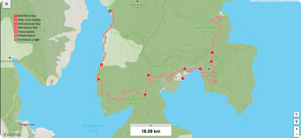
It takes about an hour to get from Picton Wharf to the start of the hike at Meretoto (Ship Cove). Once you get to the jetty, have a little wander around the bay itself, before starting on your hike. Turn right when you get to the toilets, and you’ll see a beautiful bridge crossing a small stream. Across the bridge you’ll find some signs telling you all about the bay. There is a carving or Pou here telling of the Māori history along with a Pakeha monument to the Endeavour. After you have taken in the history of this place, stop in at the toilets before you start your hike. These are flushing toilets! The nicest toilets you’ll come across until the end of the hike at Furneaux Lodge.
Start of the Trail
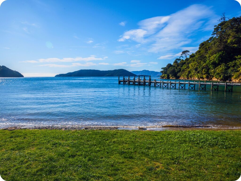
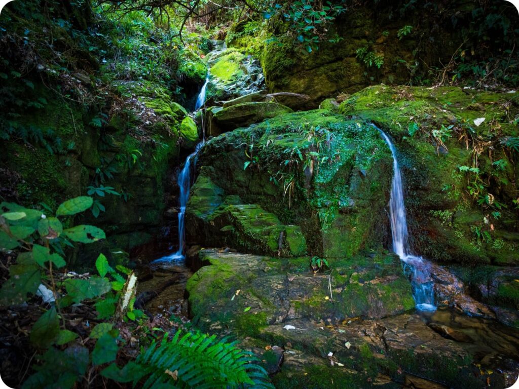
The start of the trail is well-marked with a well-formed track to follow for the entire 17kms. You’ll walk straight into the emerald green bush and start climbing up to Ship Cove Saddle. Keep an eye out for cyclists as you can both walk or cycle the Queen Charlotte track. Whilst you’ll get the odd glimpse of sparkling water through the trees your main view on this climb is the forest itself. You’ll cross a gently bubbling waterfall before reaching the top of the saddle.
Ship Cove Saddle
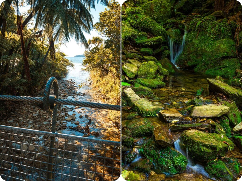
At the top of your first and steepest climb of the track, you’ll find a chair and some incredible views. If the climb up didn’t steal your breath, then these views certainly will! You are literally surrounded by amazing views of the sounds with Motuara Island on one side, and Resolution bay shimmering away on the other. From up here, you can take in the convoluted beauty of these sounds. There is a beautiful mix of water, land, water, land seeming to endlessly stretch out in front of you. It’s a coastline unlike any other, so take your time to soak it all in. This is also a great little snack stop and the perfect spot to apply your first lot of sunscreen for the day. Tiff carries a little tin of Goodbye Sunscreen that is super light in our pack and on our skin.
Schoolhouse Bay
From the saddle, stick to the marked track and you’ll have a relatively flat stretch of hiking before a slow descent down to the shores of Schoolhouse Bay. There is a little picnic table at the beach here, and a campsite a little further up the slopes of the shore. The water here is an emerald green, rather than the sparkling blue you have been seeing all morning. Stop for a snack, a swim, or just to admire the view. There is a long drop toilet at the campsite too.
Resolution Bay
As you continue on the trail from Schoolhouse bay, you may notice a sign or two attached to a tree. The signs themselves are a little odd to see on a hike, what they are advertising seems even more out of place in such a remote area.
ICE CREAM!
That’s right, if you take the detour down to Resolution Bay (and you really should), then you can pop up to a little shop there and get yourself an ice cream treat! If the ice cream isn’t tempting you, then go down to the bay just to take in another epic view of the sounds. Taking this little side trail will get you crossing another gorgeous waterfall. It really is a side track that just keeps giving. It’s not too much of a detour off the main track, and it’s worth it for the views and waterfall.
Tawa Saddle
The second climb of the track starts from the shores of Resolution Bay. Whilst this section isn’t as steep as the first climb, it is a more sustained climb up a gentle-ish slope. If you did take the side track to Resolution Bay, you’ll probably come across some sheep on the first part of your climb through farmland to join back up to the main track.
Just make sure you leave all gates as you found them so that nothing goes where it shouldn’t.
Climbing up to Tawa saddle, you’ll be surrounded by lush bush and gorgeous glimpses out into the sounds. The view changes slightly at every chance you get to see it, so stop to enjoy it (and catch your breath) before continuing on your ascent. There is a lovely babbling waterfall along this section of the trail too! You cross it just before reaching the top of Tawa Saddle. At the top there are plenty of picnic tables and chairs, so choose your favourite and stop for a lunch break with epic views.
Watch out for the cheeky weka as you’re eating, they’ll try to steal some food from you. Don’t be tempted to feed them, human food is bad for them, and we don’t want these cheeky birds getting sick.
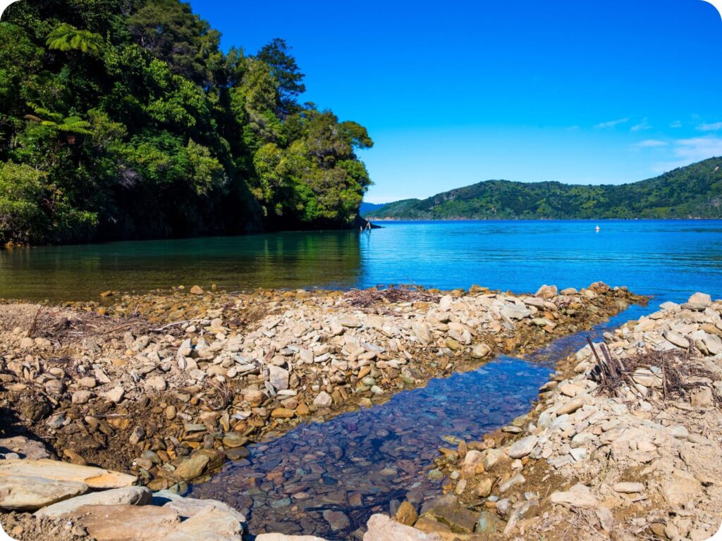
Pebble Beach
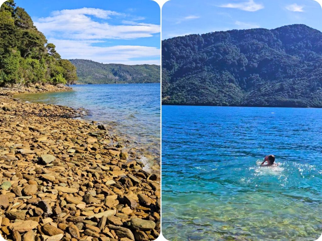
There is another long drop toilet at Tawa Saddle to make use of before you continue on your hike. From here it’s a gentle slope down to the sparkling water you were just moments ago, admiring from above. Before you know it, the track will take you down to the water’s edge at a beautifully remote and pebbly beach. Make sure you walk out to the beach itself and have a look at all the shells strewn across the rocks. Tiff took the opportunity to have a dip in the clear water here. It was cold, but so refreshing after the day’s hike. Swimming in secluded beaches you can only walk to is one of the best parts of coastal hikes like this one. Even if it is a little cold, it is so worth it to hop in the water!
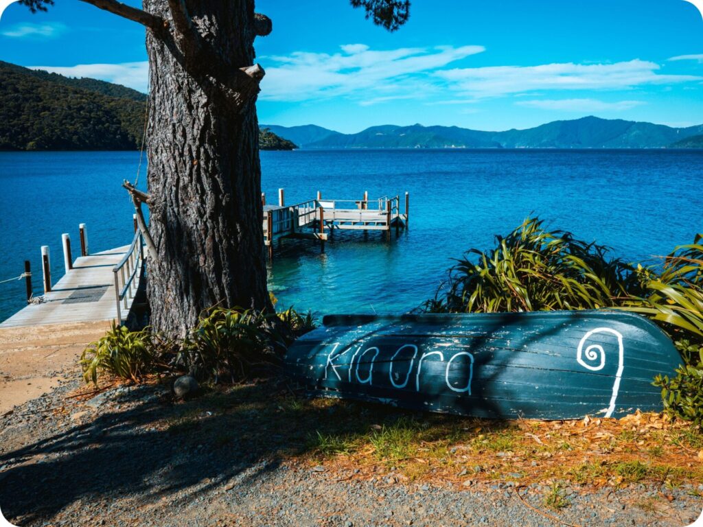
Furneaux Lodge
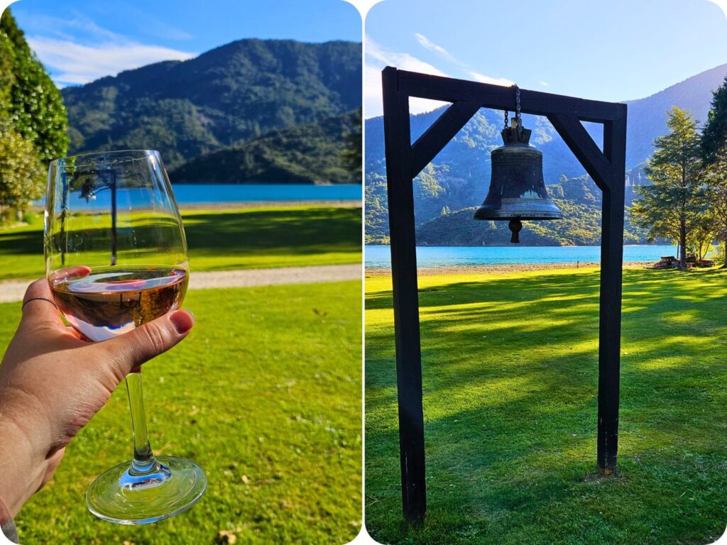
Once you’ve dried off from your dip in the sounds, it’s a flat, easy walk to the end of the track. You hug the coastline, walking past lots of private jetties and walkways up to lodges and private housing. Some people do actually live here, so you may run into a local as well! The only way in or out is by boat or hiking the rest of the 69kms that make up the Queen Charlotte Track. You’ll quickly come to the end of the hike at the water’s edge, with a very conveniently placed lodge! It’s the perfect spot to wait for your return water taxi to Picton.
We grabbed a drink each and sat outside watching the water and listening to the birds chirping whilst we waited for the peaceful boat ride back. If you got the Beachcomber like we did, make sure you sit up the top of the boat to really take in the views of the sound. Keep your eye out for some wildlife too, people have spotted sea lions, dolphins and birds from these boat rides! You never know what you might get to see out on the water.
Extra Tips & Info for Queen Charlotte Track
If you have a bit of flexibility in planning this hike, you can try to time it for some good weather. We waited until the day before the hike to book our water taxi, and commit to doing the hike, so we could do this with clear skies. It was shocking weather either side of the day we did the hike, so we did get a little lucky that our day was so good. The water taxis don’t seem to book out, so it’s worth keeping an eye on the weather before picking your day.
Please Leave No Trace
As always, when out in nature, be sure to practice leave no trace. Anything that goes into the park with you comes out as well (this includes apple cores and any type of food scraps). Be sure to keep to the trails so you don’t disturb the fragile ecosystems off the trail. Please leave rocks, sticks and plants as you find them. Please don’t take anything but photographs and leave with nothing extra but memories. We like to go one step further on leave no trace by making sure we pick up any rubbish we see along the trail, sometimes people slip up and forget to pick up after themselves, or things get accidentally forgotten. If you see something that doesn’t belong, and are equipped to pick it up, and correctly dispose of it, please do!
To help you leave no trace on these incredible day hikes, we have a few blog posts for you to read! We share our tips on how to pack for an eco-conscious day hike and what to do on the trails to protect the land you are hiking on. It’s always good to know whose land you are on, too! We have done our best to include the Tangata Whenua (people of the land) above in the local iwi section. However, it is always a good idea to do your own research as well. Knowing whose land you are on is vital in ensuring you can respect the wishes of the landowners and help to protect their land.
Keen for more inspo? Be sure to check out:
- Day Hike – Abel Tasman Track
- 10 Hidden Gem South Island Photography Spots
- Toppling The Trend: 5 Reasons To Not Stack Rocks