Rakiura was one of our absolute favourite destinations in Aotearoa, New Zealand. This stunning island paradise seems to exist outside of time itself. There is no rushing here, or need to get anything done; you just enjoy the day as it comes and go with the flow whilst the birds sing to you and the waves sparkle away. The best way to experience the chill vibes of the island is to get out into the natural spaces, of which there is an abundance. Taking an entire day to walk a section of the Rakiura Track is a great place to start.
Immersed in the lush green bush that covers the majority of the island, you’ll get to listen to the birds singing as you wander from stunning beach to stunning beach. Not to mention a calm boat ride out to the start of the track showing you all the coastline you will be walking on from a different vantage point. It is a magnificent day out with nature that can be as long as you like.
We chose to do the absolute longest option of the walk from Port William to Oban and have described all the stops and points of interest in detail for you below. You can shorten the walk by getting a taxi from the Lee Bay parking area or by not adding on the extra horseshoe point loop to your walk back to Oban from Lee Bay. It really is a choose-your-own-adventure hike, but no matter which option you choose, you will end up on a stunning coastal adventure!
Be sure to check out our Instagram to see more of our favourite day hikes around Aotearoa!
Details
Starting Point: The wharf at Oban. From here you catch a ferry to Port William Hut, where the walk starts.
Distance: We tracked 17 km on AllTrails, including a little detour to walk around Horseshoe Point.
Duration: It took us 6 hrs, including breaks for lunch, snacks and swims!
Difficulty: Easy to moderate. There are some hills, but the track is well formed.
When: We did this at the start of December. It was hot but not unbearably so and made for great swimming weather!
Local Iwi: Ngāi Tahu
Additional Information: You can shorten the walk considerably by arranging pickup at Lee Bay, the official end of the Rakiura Track. We opted to continue walking back to town and made the walk longer by adding on the Horseshoe Point loop to our hike.
Trail Map
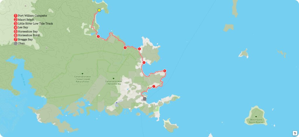
Getting to the Starting Point of Rakiura Track Day Walk
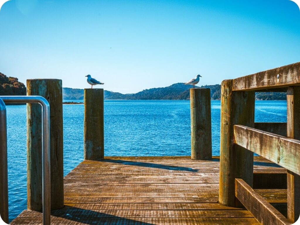
Getting to the start of this hike is an adventure in itself! You’ll need to take a water taxi out to Port William from the city wharf in Oban. You can, of course, do the walk in the other direction and end with the water taxi ride back to town, but that requires you to get to the end at a certain time, something we hate doing on hikes, as you feel a little more rushed doing it on a time crunch.
We loved our boat ride out to Port William; the water was calm and the morning was beautiful. We sat outside at the back of the small boat watching the coast go by. Our skipper was really friendly and even stopped to let us all admire a beautiful albatross just chilling in the water!
The Trail
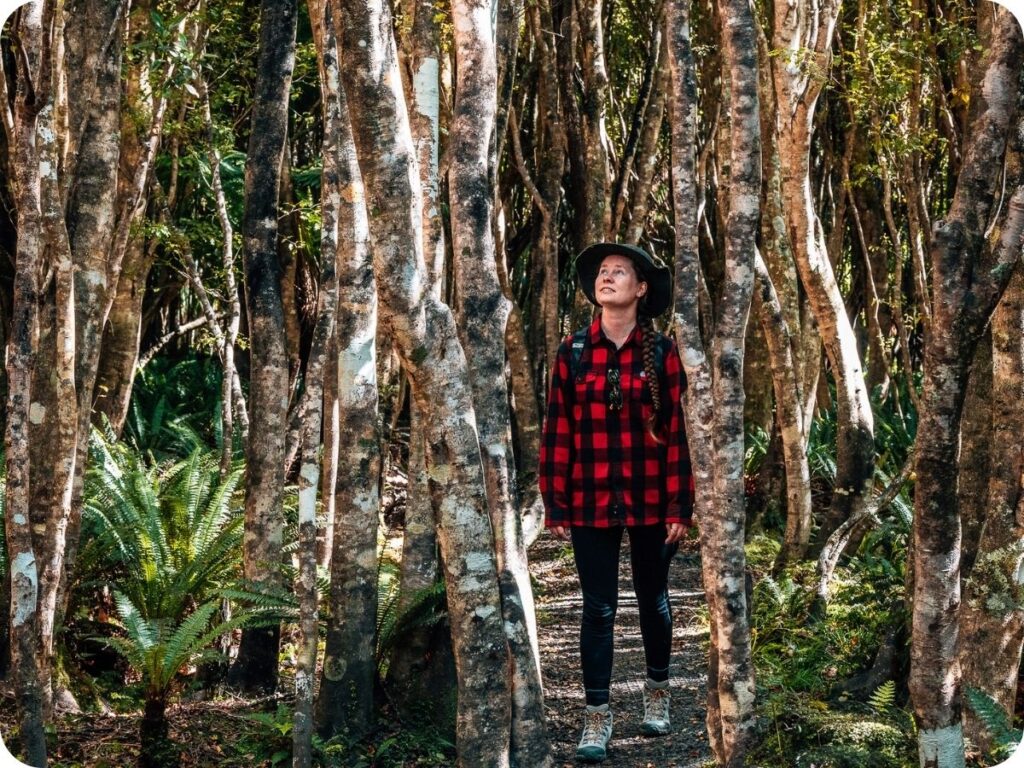
A section of this walk from Port William Hut to Lee Bay is part of the Rakiura Track, one of New Zealand’s Great Walks. It takes 3 days to complete the entire Rakiura Track, but this section will give you a lovely little taste of what that is like. Being part of a great walk, this section of the trail is well formed, with stairs and swing bridges and gravel tracks to help avoid any mud. It’s an easy enough trail to follow and very well marked out. The remainder of the walk described here includes some roads and a slightly less well-formed track around Horseshoe Point.
Port William Hut
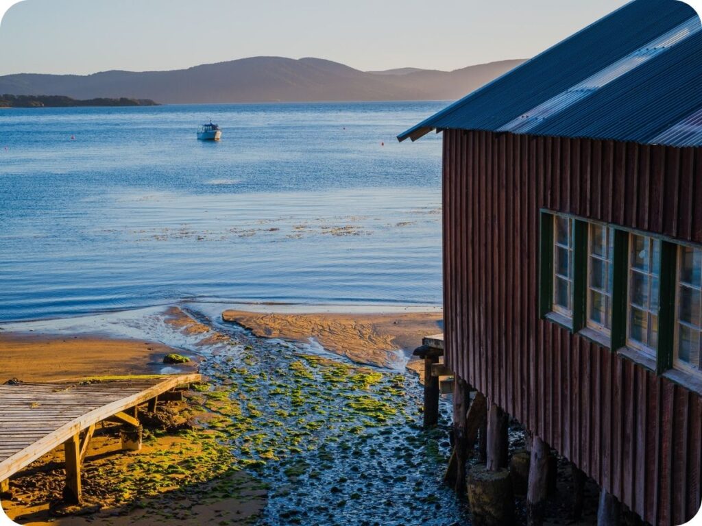
Once you get off your water taxi at the little jetty of Port William, be sure to have a wander before starting out on your hike. The bay is beautiful and steeped in history. This is where an early Māori settlement called Pā Whakataka existed. In later colonial years the area was used as a base for sealers and whalers, and in the 1870s a fishing village popped up for a time. It is now home to a DOC hut that sleeps 24 and a campground.
The bay itself is well sheltered and makes for a lovely place to start your day. From here, follow the track to the left of the beach curving around the bay, and you’ll soon begin to climb up and down the undulating headland to reach the Rakiura Track junction. From here follow the signs straight ahead to Māori Beach.
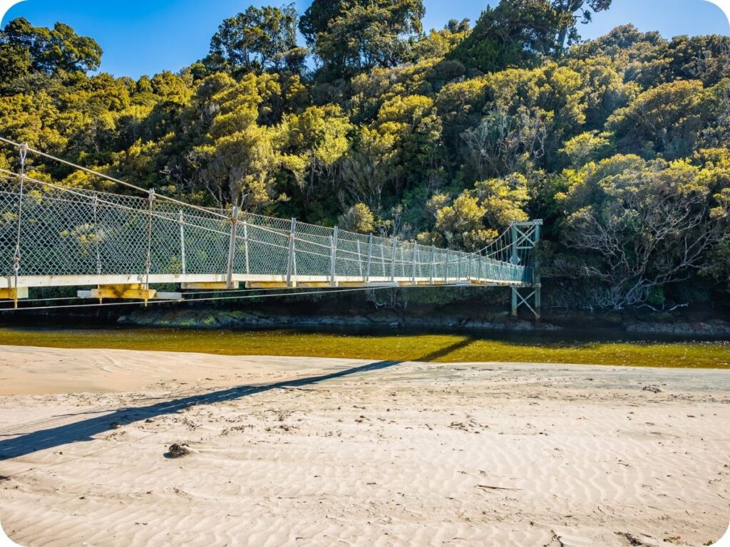
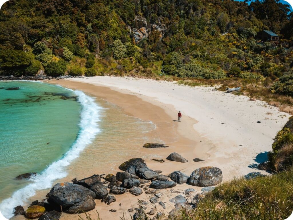
Māori Beach
You’ll start to walk back down to sea level through the dense greenery, listening to the birdsong as you go. Before you know it, the swing bridge will appear just before the beach itself, crossing over a little river-like estuary to reach the sand at the western end of Māori Beach. Follow the curve of the bay to the eastern end of the beach along the pristine white sand. Here you can duck into the bush line and find a shelter with a toilet.
If you are here at low tide, cross the little stream at the beach and stop here for a swim in the crystal-clear water. Or just have a snack on the rocks at the shoreline and admire the view like Nathan did. Once you are rested, find the large orange triangle marking the start of the track in the bush and climb up the stairs to meet the main track. Alternatively, if you come at high tide and can’t cross the stream, there is a slightly longer high-tide route that crosses the creek from the campground further inland. Keep watching the ocean views through the greenery as you follow the track along the cliff edges.
Little River Low Tide Track
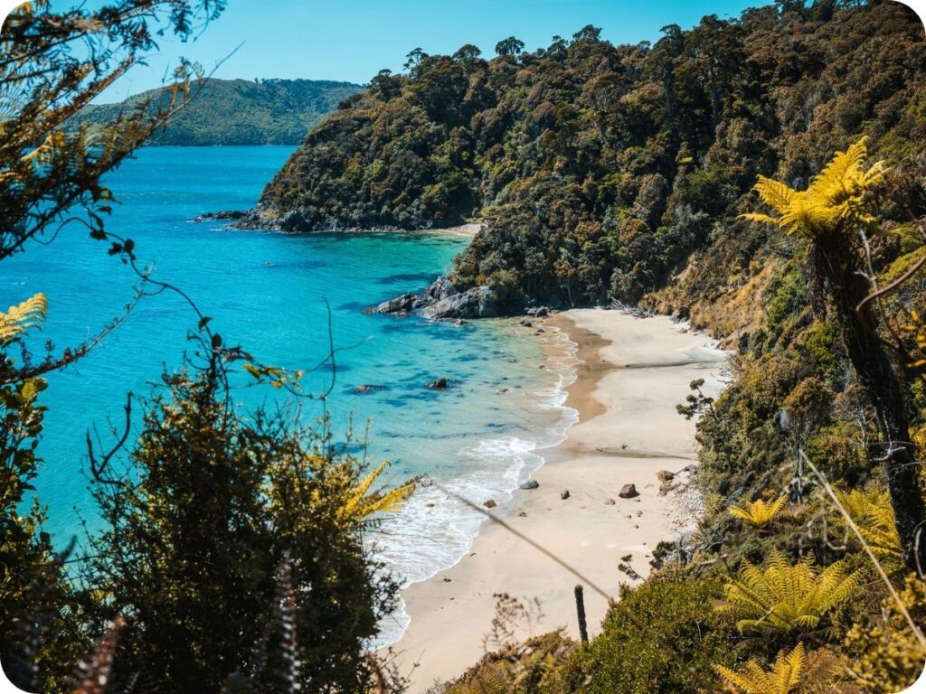
After Māori Beach you’ll soon come to a “decision point” where signs inform you of two track options, the low tide or high tide route to cross a river estuary. If you can time your walk to get here for low tide, you’ll be able to walk down some steep steps through the bush to emerge at a secluded bay. Walk along this beach to the rocky end with shady trees for a great spot to enjoy your lunch. If you aren’t here at low tide, you’ll need to continue on the main track and meet up with the low tide track at the bridge crossing the estuary river. We managed to get here close enough to low tide to take the low tide track. We had the entire bay to ourselves and ate our homemade rolls with the waves lapping merrily at our feet.
Lee Bay
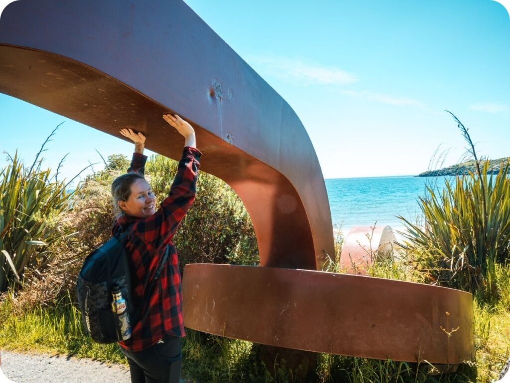
The coastal views will continue with you as you walk towards Lee bay. The water is so tempting but rather far away down the cliff as you walk on by. It’s rather reminiscent of the views on the Abel Tasman Day Hike. You’ll soon make your way down to Lee Bay and the other side of the Te Puka anchor stone chain link sculpture. The other half of the sculpture being located at Bluff. If you haven’t visited the the sculpture at bluff make sure to do so when you get back to the South Island! The two chains represent the anchoring of the South Island to Rakiura.
From here its only a short walk to the car park. If you are getting picked up by a taxi this is where you should wait for it. If not continue on up the road to Horseshoe Bay.
Horseshoe Bay
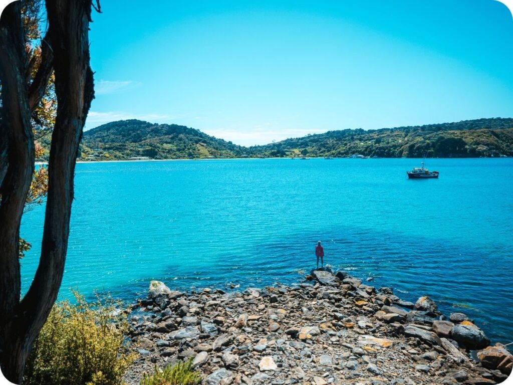
The climb up the road and then back down again to Horseshoe Bay wasn’t our favourite, as we aren’t big fans of a road walk. However, the view of the sparkling water of Horseshoe Bay at the end of the road made it worth the effort. This stunning beach was gorgeous to walk along with the waves lapping gently at your tired feet. Follow the curve of the bay around to the very end, where you will find a little island connected to the land by a man-made rocky groin. There is a rope here to help you climb up to the top of the island, which gives incredible views back over Horseshoe Bay.
Horseshoe Point
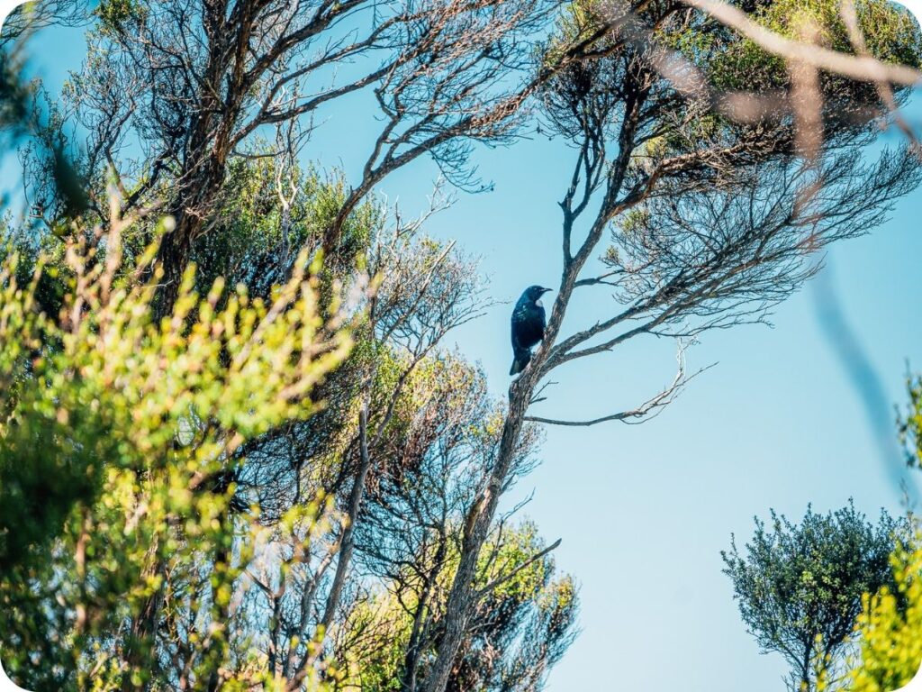
Once you have enjoyed the views and water at Horseshoe Bay, follow the Horseshoe Point Road to the start of the Horseshoe Point track. This little track takes you around Horseshoe Point with some more epic coastal views and tucked-away little beaches. There is a lookout at the top of the point with wonderful views scored by the Tuis in the bush behind you!
From the lookout you’ll continue looping around the point and following the cliff edge before dropping down to sea level at the absolutely stunning but weirdly named Dead Man Beach. A wonderful spot for a swim if you aren’t too tired from all the walking!
Braggs Bay
It’s a steep climb up the cliffs from Dead Man Beach before you cross behind some very well-placed houses to reach Braggs Bay. Another gorgeous little bay with a small island off to the side and beautiful clear water kissing the white sand. Sadly from here you’ll be following the road all the way back to Oban. Follow Braggs Bay Rd up the hill to join onto Horseshoe Bay Road, which will take you the remainder of the way into the town of Oban.
Oban
The last stretch of this hike along the road to Oban seems to stretch on forever, especially with the sun beating down on you! Just keep reminding yourself that you are walking into town, which is well equipped with ice cream or beer, depending on your preferred method of cooling down after a long hike! We were lucky enough to have a car on the island and had it parked just outside the four square in town, so we picked up some ice creams and headed back to our beautiful accommodation at this little Beach Bach to cool off.
Leave No Trace On The Rakiura Track
As always, when out in nature, be sure to practice leave no trace. Anything that goes into the park with you comes out as well (this includes apple cores and any type of food scraps). Be sure to keep to the trails so you don’t disturb the fragile eco systems off the trail. Please leave rocks, sticks and plants as you find them. Please don’t take anything but photographs and leave with nothing extra but memories. We like to go one step further on leave no trace by making sure we pick up any rubbish we see along the trail, sometimes people slip up and forget to pick up after themselves, or things get accidentally forgotten. If you see something that doesn’t belong, and are equiped to pick it up, and correctly dispose of it, please do!
To help you leave no trace on these incredible day hikes we have a few blog post for you to read! We share our tips on how to pack for an eco-conscious day hike and what to do on the trails to protect the land you are hiking on. It’s always good to know who’s land you are on too! We have done our best to include the Tangata Whenua (people of the land) above in the local iwi section. However it is always a good idea to do your own research as well. Knowing who’s land you are on is vital in ensuring you can respect the wishes of the land owners and help to protect their land.
Keen for more inspo? Be sure to check out:
- The Absolute BEST South Island Day Hikes in New Zealand
- 6 Unmissable Short Walks in Waikato
- Our Favourite Quick, Easy and Cheap Van Life Meals