Te Tai-tokerau or Northland is the only subtropical region in Aotearoa. Locals refer to it as the winterless north; making it a great place to visit year round, with longer summers and milder winters than the rest of the country. In summer, the place is heaving with locals and tourists alike, all soaking up the sun and enjoying the many beaches and waterways on offer.
We visited in May and got to experience most of the hot spots without the crowds. Even though it was Autumn, the weather was great! The slightly cooler weather of May made it the perfect time to go on some epic hikes in the region without working up too much of a sweat.
There are so many amazing hikes here, that take in the beautiful Kauri forests or the epic, rugged coastlines of the region. Some even give you both of these gems in one go! These are our favourite hikes that give you a great sample of what Northland has to offer. So grab your hiking boots and pack your bathers, lets hike these 10 epic walks in Northland together!
Be sure to check out our Instagram to see more of what Northland has to offer!
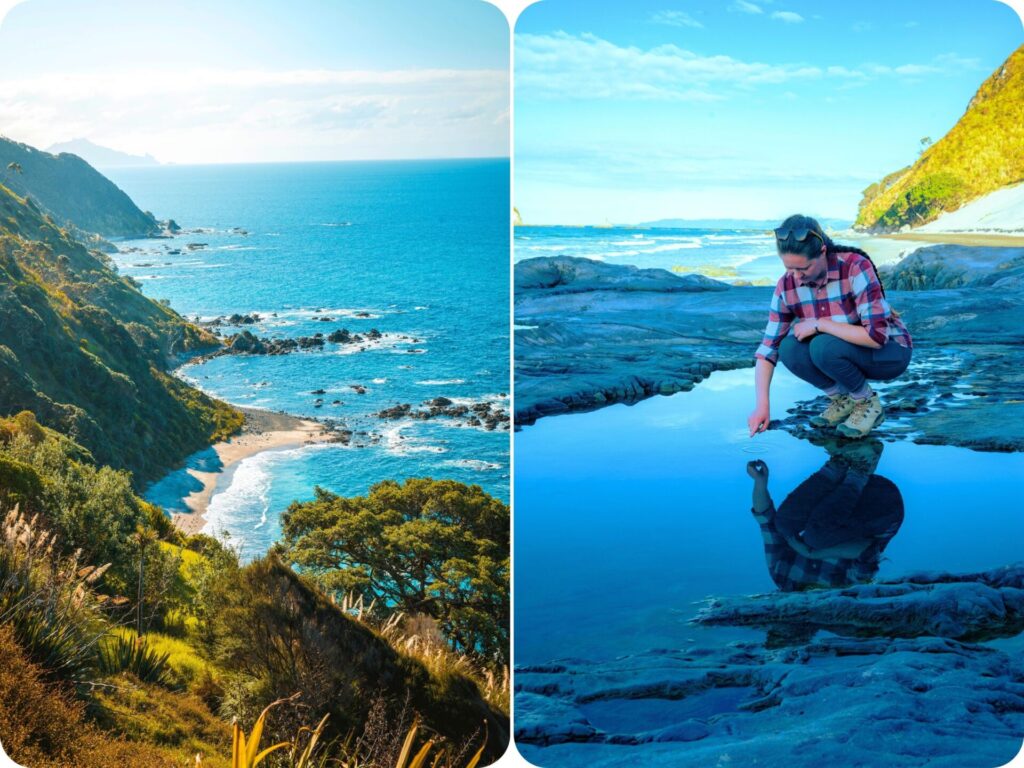
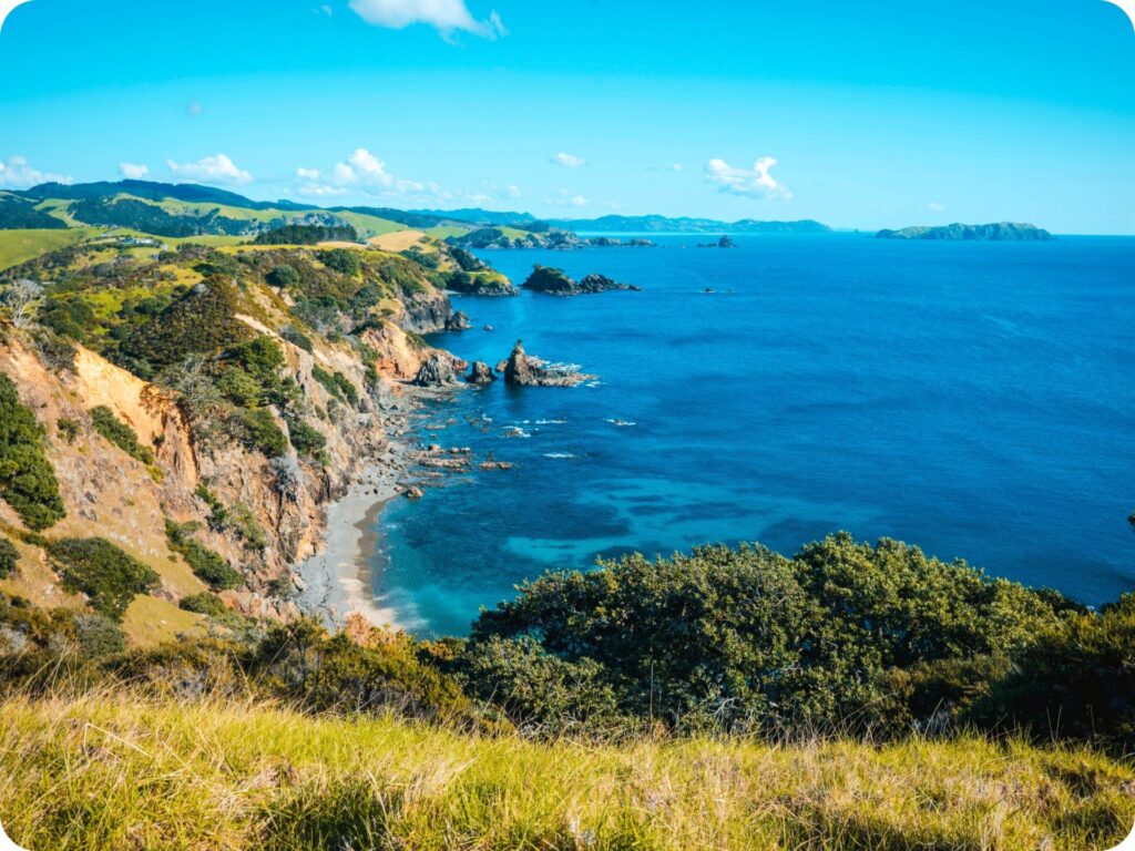
Mangawhai Coastal Walkway
Distance: 7.5km
Duration: 2hrs
Difficulty: Moderate. A sandy beach walk followed by a steep climb to the cliff tops.
Start of the Hike: Kaipara Council Car Park near the Mangawhai surf life-saving club.
If you time this hike for low tide, you’ll be able to turn it into a loop track by walking back along the beach. Come at high tide, and it’s a there and back walk along the cliff tops. We weren’t able to make it for low tide so we did the there and back option.
The hike starts along the beach, no matter what time you come. You do need to climb a few rocky outcrops at the start, but it is fairly obvious how to do this safely. You’ll then leave the beach and head up the cliffs to some amazing coastal views.
If you are here on a clear day, you should be able to see out to great barrier island and the Coromandel Peninsula. It’s a stunning walk and a great way to get a taste of all the epic coastal tracks to come as you venture further into the heart of Northland.
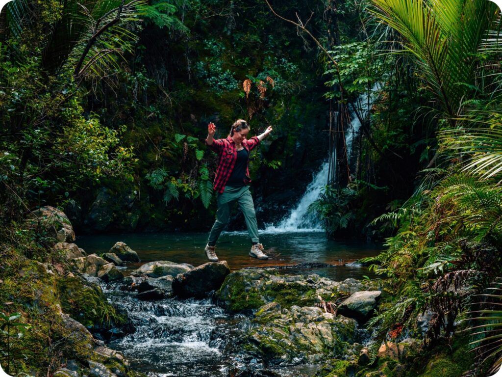
Tanekaha Walking Track and Waterfall
Distance: 5km
Duration: 2hrs
Difficulty: Moderate. This is a somewhat technical track with multiple stream crossings.
Start of the Hike: A small car park just off King Road.
Start by following the Tanekaha forest track to the swing bridge. Once you have crossed the swing bridge, continue on walking straight ahead to follow the Tanekaha Falls Track. This narrow track will take you along the river to the first waterfall of the trail. You’ll then cross back and forth along the river a few times to reach the second most impressive waterfall, and after this a third waterfall that is more like a few tall rocks the river flows over.
The track itself is a little narrow and slippery, but it is surrounded by lush green bush, and you never leave the babbling of the river for the entire walk. It’s an incredibly peaceful walk that left us feeling rejuvenated.
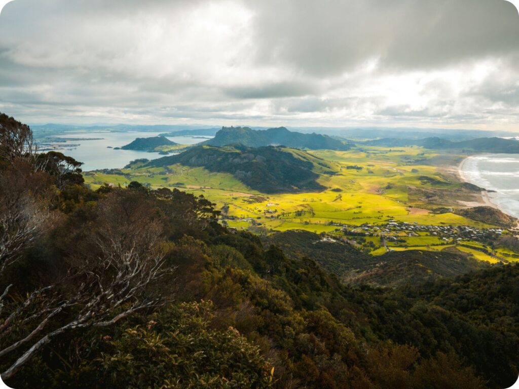
Mount Manaia
Distance: 4km
Duration: 1.5hrs
Difficulty: Moderate. A well-formed trail with a steady incline to get to the top.
Start of the Hike: Mount Manaia Club’s lower car park, just out of Whangārei.
A beautiful bush walk through Kauri trees will lead you up the mountain to a rocky outcrop at the very top. The hike up is steep in places, with some stairs to help you out. When you near the top, you’ll come across a board-walked section that has been put in to help protect the kauri trees. You then have a last steep push before you get to the steps leading up the rock-face at the top of the hill.
The views from this outcrop of rock make for a stunning natural lookout to the bay beyond. Be careful up here as there are no safety rails and some steep drop-offs.
Mount Manaia is a tapu (sacred) place to Ngātiwai, so please respect this by not eating on the hike (especially at the rocky summit) and keeping to the track provided.
Smuggler’s Bay Loop Track
Distance: 5.3km
Duration: 2hrs
Difficulty: Easy-Moderate. A well-formed track over farmland and coastal cliffs
Start of the Hike: Urquhart Bay car park in the Bream Head Scenic Reserve. There is limited parking here. We had to park the van on the street as the car park was full!
Northland is home to some epic coastline hikes and Smugglers Bay Loop Track is one of these. The track takes you around the Busby Head taking in the rugged coastline, the pristine white sand beach at Smugglers Bay and the old WWII gun emplacements still standing in the paddocks.
The walk starts off in farm land before crossing over to bush, where you can listen to the birds singing whilst enjoying the blue water of the bay. From Smugglers Bay you’ll walk back through farm land to join up to the start of the trail. Keep an eye out for some cute cows in the paddocks as you go!
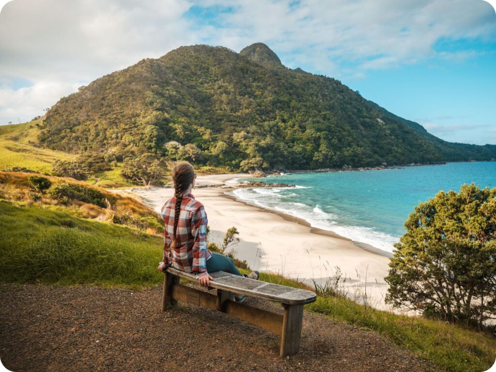
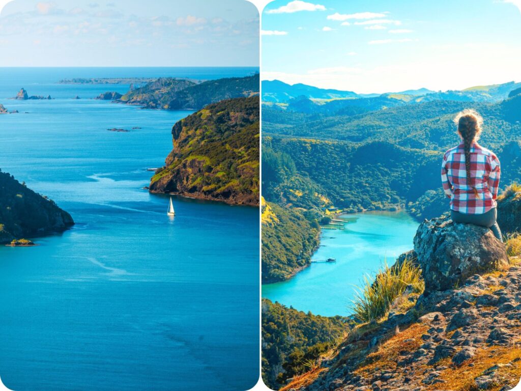
Mahinepua Peninsula Track
Distance: 5km
Duration: 2hrs
Difficulty: Moderate. An easy coastal track with quite a few inclines.
Start of the Hike: Mahinepua bay car park
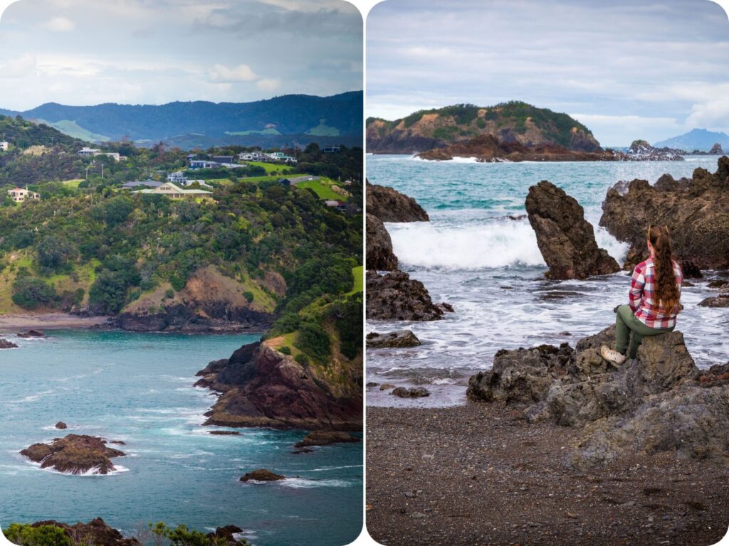
This is the coastal walk of our dreams. Panoramic picture perfect moments everywhere you look will accompany you as you meander along the peninsula. Magnificent cliffs fall away into turquoise waters, and we had the entire track to ourselves!
The track starts by walking up a driveway on private land. However, it soon leaves the drive and dips down into a quiet bay before climbing up to the rest of the headland. You’ll have your fair share of steps to climb, but it’s worth it to view all the different bays and rugged cliff side landscapes. If the weather is warm, pack your bathers and go for a dip in the secluded bay you pass towards the start of the walk.
Kaiaraara Rocks (Dukes Nose via Wairaku Stream Track)
Distance: 13km
Duration: 6hrs
Difficulty: Hard. The track has a challenging rock climb at the end and a couple of river crossings along the way. This one is for experienced hikers.
Start of the Hike: Campbell Road end, just outside of Totara North.
This is by far one of the best day hikes to do in Northland. The views out to Whangaparāoa Harbour from the top of Kaiaraara Rocks are breathtaking for more than one reason! To reach the top, and to get the views, you’ll need to climb up a near vertical rock face. Your only aid to get up there is a fixed metal rail. It’s not for the faint of heart! Nathan found this climb to be one of the highlights of the entire trail. Tiff, on the other hand, almost didn’t attempt it. If it weren’t for the fear of missing out on the views, she wouldn’t have gone up.
There is no parking at the start of the track so you’ll need to pay $5 for a spot at the nearby private parking just off Campbell Road. Or you can do what we did and pay an extra $10 to spend the night at the camp ground just down the road. We left the van here for the day so we could do the hike after spending the night before at the camp ground. The track out to the Kaiaraara Rocks is rather technical, with some muddy slippery inclines, and two stream crossings, that you really need to take your boots off for. It is, however, a stunning walk, even before you get to the views at the top of the rocks.
The Kaiaraara rocks themselves are of great cultural significance to the Ngātiwai, so please respect their request to not eat or drink on the rocks themselves.
There is a lovely day hut at the bay just before you start the climb up to the rocks, which is the perfect place to have a picnic lunch by the water.
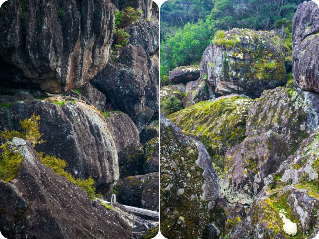
Wairere Boulders Loop
Distance: 4.5km
Duration: 2hrs
Difficulty: Easy-Moderate. Small inclines and a little muddy in places.
Start of the Hike: Wairere Boulders car park, just out of Horeke.
Wairere Boulders is a privately owned valley full of incredible rock formations, a beautiful bubbling stream, and lush green rainforest. The rock formations you’ll explore were formed by a volcano about 2.8 million years ago. The basalt rock has been slowly eroded over time to form the stunning fluted rocks of Wairere valley.
As the valley is on private farm land you will have to pay a small admission fee that helps with the up keep of the tracks. $15 per adult gives you entry for 24hrs. Pack some snacks and some good sturdy footwear and give yourself a few hours to explore the many walking trails around the unique rock formations. The track can get quite slippery so be careful, especially when walking in the paddocks. Nathan managed to slip over twice here!
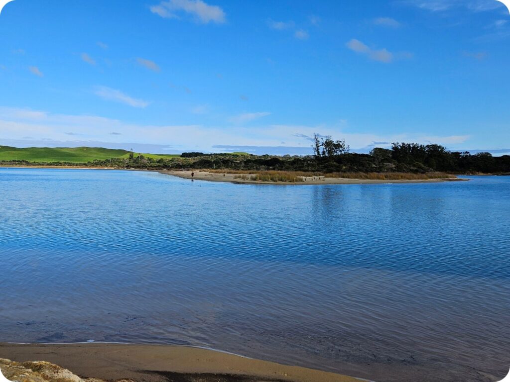
Kai Iwi Lakes – Lake Taharoa Track
Distance: 8.7km
Duration: 1.5hrs
Difficulty: Easy. A flat, well-formed track.
Start of the Hike: Kai iwi lakes camp ground, just out of Kaihu.
Kai iwi lakes are a bit of a hidden gem in Northland. The lakes are very popular with locals but don’t make it on to many tourist lists. If you come during summer they will be busy with people boating, fishing and swimming. Come in literally any other season, and you are likely to have the lakes pretty much all to yourself!
Tiff did this walk on her own whilst Nathan tried his luck at fishing the lakes. It’s safe to say Tiff had a much better afternoon than Nathan did. The lakes are crystal clear and incredibly reflective, with beautiful bush surrounding them. The walk itself is well-marked out on a good track that hugs the lake, providing great views the entire way around. It’s a wonderful walk for bird watching too, with many a bright blue kingfisher flying by and a good number of little pied cormorants sunning their wings along the bank.
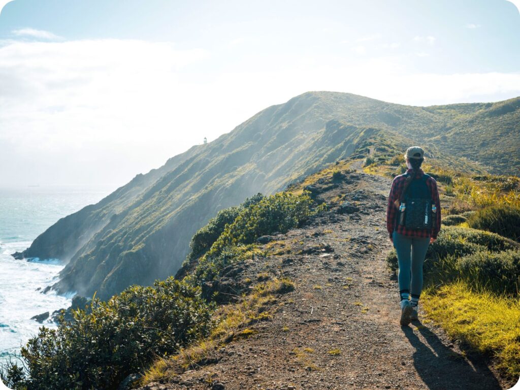
Te Rerenga Wairua – Reinga Coastal Walkway
Distance: 10km
Duration: 2.5hrs
Difficulty: Moderate. Coastal walk with a cliff top climb and beach walk.
Start of the Hike: Cape Reinga car park at the northern most point of New Zealand
Te Rerenga Wairua or Cape Reinga is an incredibly important and tapu (sacred) site in Aotearoa. There are information plates at the entrance to the hike letting you know how to show your respect for the area. Please listen to these signs and refrain from eating whilst at the cape, and stick to the paths provided.
Cape Reinga is also home to the northernmost lighthouse in Aotearoa and the start of the Te Araroa Trail. As such, you can experience a couple of different walks when you come to the area. We chose to walk down to the lighthouse and then retrace our steps partway up the lighthouse path to the start of the Te Araroa Trail. This leads you along the cliff face, away from the lighthouse and down to Te Werahi Beach on the Te Paki coastal track. Walking to the little river at the end of the beach and back up to the car park will give you a lovely 10km walk with great views of the lighthouse at the start of the walk and views out to Motuopao island at the end of the beach. We sat on the beach eating our lunch and watching the clouds come in over the island.
Tutukaka Lighthouse Track
Distance: 2.5km
Duration: 1hr
Difficulty: Easy. A short but steep climb.
Start of the Hike: Carpark at the end of Landowner’s Ln. This is a private road, however, the public is permitted to drive on it to reach the Department of Conservation car park at the end of the road.
This is a tidal hike and as such access to the track is only possible 2hrs either side of low tide. If you come at high tide, you won’t be able to cross to the lighthouse. Now when we say ‘lighthouse’ we don’t mean the traditional lighthouse building you’ll be picturing right now. This is more of a lighthouse in the nautical sense that it is a signal to boats that there is land here.
So don’t come on this hike expecting a pretty lighthouse at the end.
Do come on the hike expecting some stunning coastal views, a rocky tidal beach, and, on a good weather day, views all the way out to Poor Knights Islands. It’s a lovely short walk that is considered some of the best coastal views in Tutukaka.
Please Leave No Trace
As always, when out in nature, be sure to practice leave no trace. Anything that goes into the park with you comes out as well (this includes apple cores and any type of food scraps). Be sure to keep to the trails so you don’t disturb the fragile ecosystems off the trail. This is particularly important in Northland, as the kauri trees are very susceptible to disease transferred from dirty gear to their roots. Most hikes in Northland will have a shoe and gear cleaning station at the start of the trail to prevent the spread of dieback to kauri. Please use these when you enter and leave the trail. Not only does it protect the trees, it helps your gear last longer too!
Please leave rocks, sticks and plants as you find them. Please don’t take anything but photographs and leave with nothing extra but memories. We like to go one step further on leave no trace by making sure we pick up any rubbish we see along the trail, sometimes people slip up and forget to pick up after themselves, or things get accidentally forgotten. If you see something that doesn’t belong, and are equipped to pick it up, and correctly dispose of it, please do!
To help you leave no trace on these incredible day hikes, we have a few blog posts for you to read! We share our tips on how to pack for an eco-conscious day hike and what to do on the trails to protect the land you are hiking on. It’s always good to know whose land you are on, too! The region of Northland has 9 iwi with tribal boundaries within the area. Knowing whose land you are on is vital in ensuring you can respect the wishes of the landowners.
Keen for more inspo? Be sure to check out:
- 6 Unmissable Short Walks in Waikato
- 17 Epic Free Things to Do on New Zealand’s West Coast
- Day Hike – Pouākai Crossing