Disclosure: This post contains affiliate links. If you make a purchase through these links, we may earn a small commission at no extra cost to you. We only recommend products we personally use and trust
One of our favourite days out in Tāmaki Makaurau (Auckland). This incredible volcanic Rangitoto Island hike has it all. From a ferry ride to get to the island, a climb up to the top of the volcanic cone and some lava caves to top it all off. The beaches found on the island are stunning as well. On a hot day after a hike to the top of the volcano, they are the perfect place for a dip before returning via boat to the city. The views along the way are stunning and well worth the climb to the top. Pack yourself a picnic and spend the day tramping around the island.
Be sure to check out our Instagram to see more of our favourite hikes!
Details
Starting Point: Auckland Viaduct Harbour to catch the ferry to Rangitoto Island
Distance: AllTrails – 14km. Exactly what we did.
Duration: 4.5 hours
Difficulty: Moderate
When: April
Local iwi: This is an overlapping tribal area between 9 iwi. Ngāi Tai, Ngāti Maru, Ngāti Pāoa, Ngāti Te Ata, Ngāti Whanaungatanga, Ngāti Whātua Ōrākei, Te Kawerau a Maki and Te Rūnanga o Ngāti Whātua. (In Alphabetical order)
Additional Information: Bring your sunscreen! There isn't a lot of shade.
Trail Map

Getting to the Starting Point of Rangitoto Island Summit Loop
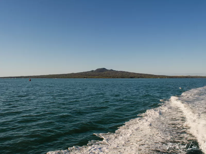
It's a 25 minute ferry ride departing from Auckland city. Make sure to book your return tickets in advance to avoid any disappointment. The island itself has toilets, but that's it! So pack yourself any food and water you'll need for the day. We took along a picnic and two water bottles each, which proved to be plenty. Pay attention to the time of the last boat. If you miss it, you'll have a very expensive water taxi fee or a night stuck on the island.
We recommend going during the week to avoid the crowds. We didn't think the island would be too busy and went during the Easter long weekend. We were very wrong indeed! Plenty of people joined us on the climb up to the top of the volcano. It was a little too crowded for our liking. However, the crowds lessened as we walked further away from the summit and out to the Islington bay and around.
The Trail
Starting at the wharf, follow the signs for Rangitoto summit. It's a well-formed track that leads you to the top of the volcano. You'll pass through some pōhutukawa trees, but the dominant landscape is that of volcanic rock and lava flows. It's rather other worldly to walk through. Be sure to stop at the signs along the way and read about the volcanic rock.
Lava Caves
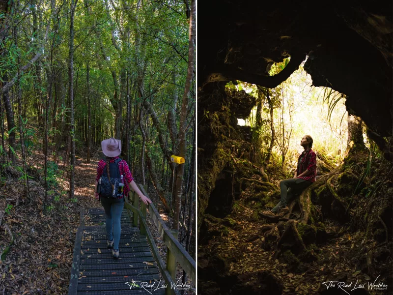
You'll come to a nice little shaded clearing with signs for the lava caves. These are not to be missed! It's a short 15 minute detour each way to reach the caves. Keep in mind that there are, in fact, two caves you can visit here. Once you've seen the first one, follow the track a little further along to a longer cave that you can walk through. You'll need to use your phone or a torch in the second cave to get all the way through. It's an awesome little adventure and the caves are beautiful. The track to the caves is beautifully shaded so enjoy this whilst you can as the shade disappears quickly as you continue the climb up tot he summit.
Rangitoto Island Summit
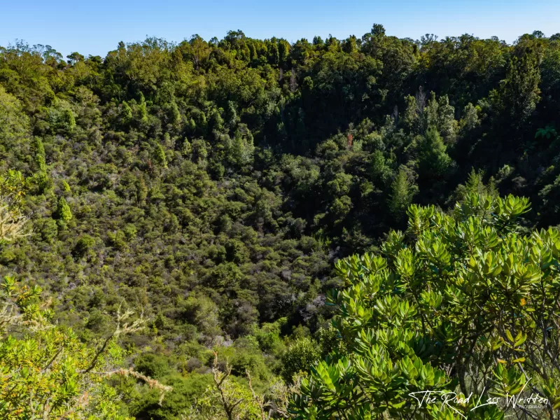
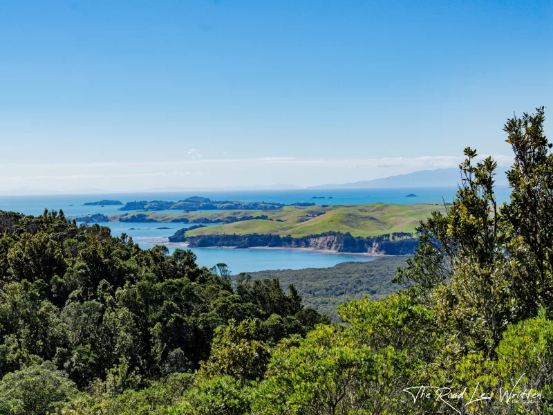
You'll reach the crater rim before you get to the summit of the island. Looking down into the 60m deep crater, you'll find it's filled with native bush instead of boiling lava. Sorry to disappoint! From here, follow along the rim of the crater to the left and you'll shortly reach the summit and viewing platforms. The view out to Auckland is beautiful, but we enjoyed sitting with our backs to Auckland facing towards the open ocean and other islands in the bay. There is a building on the top here, leftover from the days of WWII when the island was used as a great vantage point to watch vessels entering Auckland harbour. From here, keep following the crater rim until you see the signs for Islington Bay Wharf.
Islington Bay
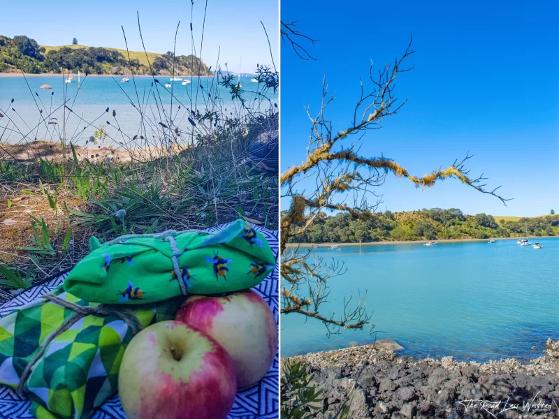
This peaceful bay is the perfect spot to stop for lunch. We sat in amongst the trees, watching the waves gently lap at the shore. The crystal blue water is incredibly inviting and a worth having a dip in before continuing along the coast. You'll follow the curve of the bay around to Yankee Wharf and a little further before leaving the water, so if you aren't in the mood for a swim after lunch, be sure to jump in the water before the trail heads inland. After Yankee Wharf, follow the signs back to Rangitoto Wharf to catch your return ferry. The track cutting through the island is rather rough, but provides gorgeous views of the lush bush and exposed lava rocks.
Fun facts on Rangitoto Island
Rangitoto is the youngest volcano in the Aotearoa having erupted only 600yrs ago. Given its isolation from the mainland, it is a predator free zone and haven for endangered native birds. To protect the island from invasive species, remember to clean all your hiking gear before getting on your ferry and, of course, do not bring any pets to the island. Cleaning your gear will also protect the bush and Pōhutukawa trees, which make up the largest Pōhutukawa forest in the world.
The island's full name is 'Nga Rangi-i-totongia a Tamatekapua' translated to English this means 'the day the blood of Tamatekapua was shed'. A major battle between the chief of the Arawa canoe (Tamatekapua) and the local iwi, Tainui, was fought in Islington bay on the island. Thus resulting in the name. For more information on the island and the Māori myths associated with it go to (link from doc here).
Keen for more inspo? Be sure to check out:
- Day Hike – Auckland Coast to Coast
- Top 5 Free Things to do in Auckland
- Top 10 Things to do in Waikato
Want to know more about our story?
- From Auckland to Vanlife: Our Journey to Freedom on the Road
- A Pandemic Journey: Navigating Travel to Aotearoa During Lockdown
- Our First Taste of The Road Less Written
Resources: